Home › Festivals › Eden Cherry Blossom Road Festival
Eden Cherry Blossom Road Festival
- 📅 Dates
- Apr 11, 2026 – Apr 19, 2026
- 📍 Location
- 139 Edenbeotkkot-gil, Gapyeong-gun, Gyeonggi-do
- 🎫 Admission
- Free
- 🕘 Hours
- 10:00-20:00 (Saturday-Sunday only)
- 🎪 Venue
- Area of Edenbeotkkot-gil, Cheongpyeong-myeon, Gapyeong-gun, Gyeonggi-do
- 🏛️ Organizer
- Olive Star
- ☎️ Contact
- +82-31-585-0025
⚠️ This festival's listed dates have passed
The dates above are from the most recent official schedule. Many Korean festivals are annual events held around the same time each year, but the next date has not been officially confirmed yet — please check the official website or a Google search below before planning a trip.
Overview
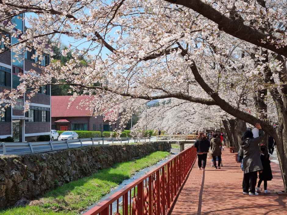
The Eden Cherry Blossom Road Festival satisfies the five senses of youngsters by enjoying not only the cherry blossom tunnel, but also stage performances of classical and popular songs, a handmade flea market, local specialties in Gapyeong, and colorful food.
Source: Korea Tourism Organization (official English translation, TourAPI).
🇰🇷 Copy this into Naver Map or Kakao Map
Google Maps cannot give walking or transit directions inside Korea — Korean law restricts map-data export. Naver Map and Kakao Map can, but they find far more when you search in Korean. Copy and paste:
📊 How busy this area gets
Visitor-volume index for 가평군, from Korea Tourism Organization big data. 1.00 = that area's own yearly average, so this compares the area against itself — not against Seoul.
The index covers the whole district, not the festival ground itself. Use it to pick a month, not a day. · Oct 1.10 / Aug 1.38
🅿️ Nearby attractions — with actual parking capacity
Most sites only say "parking available." These are official figures from the Ministry of the Interior and Safety, so you can judge before you drive.
Names and addresses here stay in Korean on purpose. Google Maps cannot give directions inside South Korea, and NAVER Map / KakaoMap find these places only under their Korean names — copy an address above and paste it straight in.
🏮 Traditional market days during the festival
Korean country markets open only on days ending in fixed digits — every 5 days. These are the actual dates they open while the festival runs, so you can add one to the same trip.
Names and addresses here stay in Korean on purpose. Google Maps cannot give directions inside South Korea, and NAVER Map / KakaoMap find these places only under their Korean names — copy an address above and paste it straight in.
🎪 Other festivals nearby at the same time
Overlapping dates, within 60 km.
Nearby Attractions
Places within 12 km of the festival venue (straight-line distance), described in English by the Korea Tourism Organization. Travel time depends on roads and traffic, so only distance is shown.
-
Saekhyeon Tunnel색현터널 Attractionapprox. 0.9 km
Saekhyeon Tunnel, spanning 423 meters in length, was first opened in 1939 and functioned as part of the Gyeongchun Line railway up until 2010. After the railway line was…
Korean address for map apps경기도 가평군 청평면 에덴벚꽃길 39-1 -
Homyeonghosu Lake Park호명호수공원 Attractionapprox. 3.7 km
Homyeonghosu Lake Park, located on Homyeongsan Mountain, offers scenic walking trails around the lake. A notable feature of the lake is a turtle-shaped structure…
Korean address for map apps경기도 가평군 청평면 상천리 -
Nami Island남이섬 Attractionapprox. 4.4 km
Nami Island, with the concept of "Fairy Tale Village and Song Village," provides various cultural events, concerts, exhibitions, and more to give children dreams and…
Korean address for map apps강원특별자치도 춘천시 남이섬길 1 남이섬 -
Nami Island Zip Wire남이섬 짚와이어 Attractionapprox. 4.8 km
Nami Island Zip Wire is an eco-friendly leisure facility established by Gapyeong County Office in partnership with Gyeonggi Tourism Organization and Nami Island Inc. It…
Korean address for map apps경기도 가평군 가평읍 달전리 144-5 -
JARA ISLAND자라섬 Attractionapprox. 5.5 km
JARA ISLAND takes its name from its view of a hill resembling a terrapin, "jara" in Korean. Comprising four smaller isles Dongdo, Seodo, Jungdo, and Namdo the island is…
Korean address for map apps경기도 가평군 가평읍 자라섬로 60
Google Maps cannot provide driving or transit directions inside South Korea. Paste the Korean addresses above into NAVER Map or KakaoMap — both work with these addresses and are what people here actually use.