Home › Festivals › Gwangyang Maehwa Festival
Gwangyang Maehwa Festival
- 📅 Dates
- Mar 13, 2026 – Mar 22, 2026
- 📍 Location
- 55 Jimak 1-gil, Gwangyang-si, Jeonnam-Gwangju Special Metropolitan City
- 🎫 Admission
- Adults 6,000 wonTeenagers 5,000 won * Tickets are compensated in full as a cash voucher for purchasing products at local businesses
- 🕘 Hours
- 06:00-19:00
- 🎪 Venue
- Area of Gwangyang Maehwa Village
- 🏛️ Organizer
- Gwangyang-si · Gwangyang Maehwa Festival Organization Committee
- ☎️ Contact
- +82-61-797-2721
⚠️ This festival's listed dates have passed
The dates above are from the most recent official schedule. Many Korean festivals are annual events held around the same time each year, but the next date has not been officially confirmed yet — please check the official website or a Google search below before planning a trip.
Overview
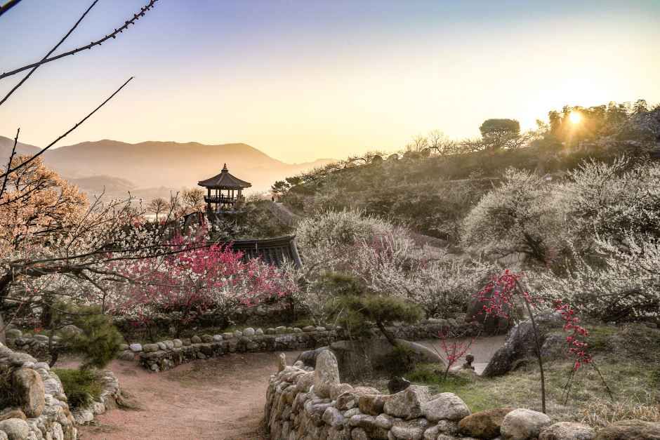
Gwangyang Maehwa Festival takes place next to the Seomjingang River in Gwangyang Maehwa Village, home of the largest number of plum blossom trees in Korea. During the festival period, visitors can enjoy a walk beneath the plum blossoms, and also sample and purchase local organic plum products.
Source: Korea Tourism Organization (official English translation, TourAPI).
🅿️ Nearby attractions — with actual parking capacity
Most sites only say "parking available." These are official figures from the Ministry of the Interior and Safety, so you can judge before you drive.
Names and addresses here stay in Korean on purpose. Google Maps cannot give directions inside South Korea, and NAVER Map / KakaoMap find these places only under their Korean names — copy an address above and paste it straight in.
🏮 Traditional market days during the festival
Korean country markets open only on days ending in fixed digits — every 5 days. These are the actual dates they open while the festival runs, so you can add one to the same trip.
Names and addresses here stay in Korean on purpose. Google Maps cannot give directions inside South Korea, and NAVER Map / KakaoMap find these places only under their Korean names — copy an address above and paste it straight in.
🎪 Other festivals nearby at the same time
Overlapping dates, within 60 km.
Nearby Attractions
Places within 12 km of the festival venue (straight-line distance), described in English by the Korea Tourism Organization. Travel time depends on roads and traffic, so only distance is shown.
-
Gwangyang Maehwa Village광양 매화마을 Attractionapprox. 0.5 km
Following the Seomjingang River flowing down the outskirts of Jirisan Mountain is a village filled with plum trees. This village, Seomjin Village, is also known as the…
Korean address for map apps전라남도 광양시 다압면 목길 34-2 -
Pyeongsari Park평사리공원 Attractionapprox. 7.1 km
Situated along Seomjingang River between Gurye and Hadong, Pyeongsari Park was built for the enjoyment of summer tourists to the area. In addition to the beautiful…
Korean address for map apps경상남도 하동군 악양면 평사리 -
[Hadong Pak Kyongni Toji-gil Trail 1] Seomjingang Pyeongsa-ri Park to Hwagae Market[하동 박경리 토지길 1코스] 섬진강 평사리공원~화개장터 Travel courseapprox. 7.3 km
Hadong Pak Kyongni Toji-gil Trail 1 offers a scenic route around the Pyeongsa-ri fields, famously depicted in the novel Toji (The Land) by prominent Korean novelist Pak…
Korean address for map apps경상남도 하동군 악양면 평사리 81 -
Pyeongsari Field평사리들판 Attractionapprox. 8.5 km
Pyeongsari Field was created by Seomjingang River flowing through the canyon which attracted people to form a village. The field served as the central farming field and…
Korean address for map apps경상남도 하동군 악양면 평사리 -
Choi Champandaek (House of Choi Champan)최참판댁 Attractionapprox. 9.3 km
The House of Choi Champan is known as the setting of the famous novel "Toji" ("The Land") by noted novelist Park Kyongni. Located in a small folk literature village in…
Korean address for map apps경상남도 하동군 악양면 평사리길 66-7
Google Maps cannot provide driving or transit directions inside South Korea. Paste the Korean addresses above into NAVER Map or KakaoMap — both work with these addresses and are what people here actually use.